These two files were in an envelope with a return mailing address of Ranstead S. Lehmann, Attorney at Law, 167 Du Page Street, Elgin, Illinois; labeled Final Receipt for Farm.
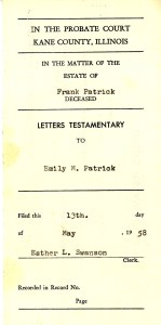
One is a probate document which I’ll probably put with my genealogy stuff since it gives Grandpa Patrick’s date of death.
The other document is for the sale of the farm. It’s really too hard for me to figure out and I don’t have a scanner large enough to copy the whole thing, but one thing that stands out is how they determine the exact location of the farm and land. Back then I don’t think they had actual addresses for this particular area. In fact, all my Dad had to write on a post card to his sister who still lived on the farm was her name, town, and state. And when his mother wrote to him, the return address on the letter was simply Hampshire, Illinois.
This would be a lot to write on an envelope:
All that part of the following described premises lying Easterly from the Highway known as the St. Charles and Genoa Highway running Northwesterly and Southeasterly through the premises herein described: The southwest quarter of the northeast quarter, the south half of the northwest quarter of the northeast quarter, the east 17.36 chains of the south 23.04 chains of the northwest fractional quarter and the north 27.50 chains of the west half of the southeast quarter of Section 30, Township 41 North, Range 7 East of the Third Principal Meridian, in the Township of Plato, Kane County, Illinois (except that part of the above described premises lying westerly of the center line of the Highway; ALSO excepting approximately one acre of land and improvements thereon in the northwest corner of the farm same to be surveyed).
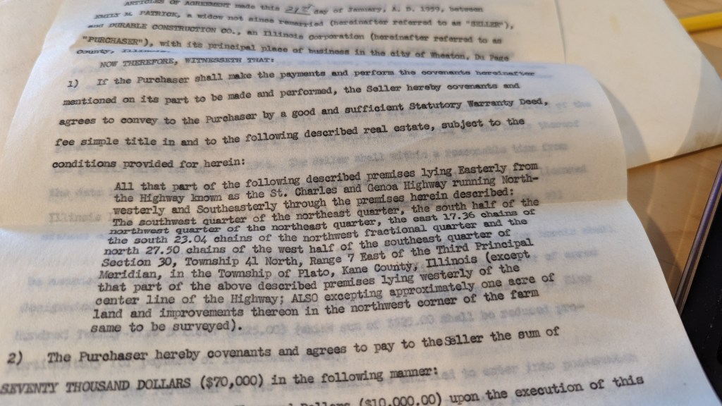
Of course I don’t think I have ever seen a location described in surveyor language, so this is possibly perfectly normal.
